This website is now archived. To find out what BERG did next, go to www.bergcloud.com.

Blog posts tagged as 'cities'

Breaking Out & Breaking In at Studio-X, NYC, Monday 30th April

Columbia University’s Studio-X NYC is hosting a fascinating evening that I’m going to be part of to close-out their “Breaking In & Breaking Out” virtual film festival focusing on the interplay of architecture with daring heists and escapes in the movies.

I’m going to speak a little bit about infrastructure, phones, watches, time and timetables – following on from this short post of mine from a while back.

But – mainly I’m going to listen – to the amazing line-up of actual serving and ex-FBI heist experts that has been assembled for the evening…

Hope to see you there.

A few links for your Friday

Matt Jones sent this lovely bit of musical mojo – “a collaborative music and spoken word project conceived by Darren Solomon from Science for Girls” –  to the studio a couple of weeks ago, and I immediately spent at least twenty minutes playing with it. Hypnotic.

Matt Webb found this gorgeous isometric map of Hong Kong. I’ve not yet been to Hong Kong, but looking at it from this perspective, the immense density of the city started to sink in. Look at all those high rise buildings smushed in together!

Via Alice Taylor ‘s round-up of Toy Fair USA we discovered Kauzbots. How great are these? You get a cuddly handcrafted robot toy and support a good cause at the same time. I think several people I know may be getting these as gifts this year.

Finally, in case you missed it yesterday, the last Discovery space shuttle mission launch:

We’ve been sending humans into space for fifty years now, and there are two main thoughts that usually occur to me whenever I reflect on the fact of space flight: 1) “WTF?! We send people into space! There are people LIVING in space on the International Space Station! Un-effing-believable!” and 2) In the 1960s people expected by now that we’d have colonised the moon and interplanetary travel would be no big deal. What happened? Why aren’t we there yet?

Totems and City Avatars

Keyring

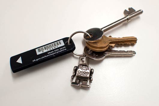
At one point during City Tracking, I commented that I still felt a connection to London during my time in San Francisco through the bike-key on my keyring (above).

(If you’re not aware of London’s cycle hire scheme – it’s a system of bike rental whereby bikes, distributed between docking stations around the city, can be unlocked with a plastic “key” and a small fee. It’s similar to Paris’ Vélib).

I suppose that could have mentioned my Oyster Card, but that usually lives tucked away in my wallet. The bike-key was something I touched several times everyday; it acts as a kind of key-fob for me.

I mentioned that, for me, the key acted as a kind of what Mike Kunivasky calls a Service Avatar. As Mike explains in his Microsoft Social Computing Summit talk:

“…because these things are now connected, their value moves from the device to the service it represents, and the actual objects become secondary. They become what I call service avatars.”

Mike is talking about electronic devices like digital cameras and TVs at this point in his talk – things that have functionality within them that is then connected to a service.

The bike-key has no functionality without the service: it’s just an RFID tag inside a piece of plastic. The service itself is unavoidably located in London. The computer systems that run it do not have to be, but the bikes themselves – the critical hardware within the service – cannot be located anywhere else.

The city and the service are tied together.

And so, for me, that keyfob that I pass through my fingers when I pick my keys up, or fidget with them in my pocket, is not just a service avatar; it’s an avatar for a city.

Then, of course, I have to unpack what I mean by “city”: not only the architecture and built environment, but also: the people within it; the transit systems that I experience so much of it through; the service layers including power, utilities, and even the payment schemes such as Oyster; the many digital layers on top, Foursquare and Gowalla and geotagged photos on Flickr and so forth.

The bike-key touches all of these: the built environment of the roads, the transit map, payment services, the digital infrastructure. It’s not just an avatar for a single service; in some ways, it’s an avatar for the entire “stack” of the city.

Time for a slight confession.

When I described the bike-key, I described it as a totem of London that I carried with me. When I said that, I wasn’t really referring to the traditional notion of an object describing the structure of kinship groups – although there are definitely comparisons to be drawn there, which Elizabeth Goodman touched on in her session on the final day.

My reference was more rooted in popular culture.

Totem

In Christopher Nolan’s recent film Inception, characters keep “totems” – small objects that behave in recognisably unique ways that only their owners know – to prove that they are truly in the real world to themselves (as opposed to being in one of the dream landscapes in which much of the film takes place).

All the totems seen in the film are objects with particular physical qualities – a spinning top, a loaded die, a poker chip, a weighted chesspiece – that behave in very particular ways (toppling, spinning) when subjected to the laws of real-world physics. Their totems prove that the laws of reality are in effect.

Nolan’s “totems” are reminders not just of the real world – but of the system that world runs on.

The bike-key in my pocket is a totem reminding me of larger systems – both the London bike network, and the city itself.

In San Francisco, it was a tangible reminder that London is still there, even though the key had no functionality in this particular city. Returned to London, the plastic key regains its powers, and returns to its normal behaviours: unlocking bicycles, capturing my usage of those bikes in its system.

As the city becomes increasingly networked – as Adam Greenfield describes eloquently in this post on the Urbanscale blog – there will inevitably be parts of that network, and thus parts of the city, that I can take with me.

On my keyring, everywhere I go, I carry a piece of London.

Four Thousand Years of Urban Growth

Chandler book cover

In his opening session at City Tracking, Stamen‘s Eric Rodenbeck showed us this book. Tertius Chandler’s Four Thousand Years of Urban Growth is a historical census of the world, derived from almost any source Chandler can find.

The book sat on the front table in the room we were sharing for the duration of the conference; a constant reminder of cities past and present, fallen and still-standing. I spent some time skimming through it, and found its contents as marvellous as Eric intimated.

In the first section of the book, Chandler tours the world, listing individual cities and their populations over time.

Dieppe

Here’s some of the listing for Dieppe, in France.

As well as a running total, there’s a citation for how that figure was derived. Sometimes, it’s based on direct quotation. But sometimes, it’s based on something more like a calculation. For instance, that 1600 figure for population is based on the number of churches in the city, and the average congregation size for those churches.

Baghdad

Here’s some of the listing for Baghdad, around the 8th century AD. In 932 AD, he uses several sources: the number of doctors (and how many citizens they served); the number of baths in the city; and the area the city covered. His final figure – of 1.1 million – is closest to the estimation derived from area. Chandler includes other figures in his notes, even if he’s not comfortable with their accuracy; see, for instance, the “reputedly 2,000,000” in 833, derived from the 1910 Encyclopedia Britannica. Chandler is clearly happier with the more conservative estimate derived from the area in the 1960 Encylopedia of Islam.

City tables

At the end of the book are tables of the world’s largest cities listed by era, with their populations. These are some of the listings for a few thousand years ago.

Finally, there’s a short textual appendix that serves as a short biography of the forty largest cities in each century, from 100-1970. From all his numbers and tables, Chandler weaves a narrative of how the world’s powers and economies have shifted and changed. For instance:

“China dominates the first city tables. At 1400 and 1500 it has each time 11 of the 40 cities. At 1600 China still has the topmost place, and 2 of the top 10, but Spain, with only one in the top 10, barely trails China overall with 6 to China’s 7. The Spanish cities include 1 in America, 1 in Portugal, and 3 in Italy. In 1700 China is ahead again with 9. In 1800 it has 9, as to 10 in the burgeoning British Empire, albeit the latter has only 1 on Britain itself. Britain and China thus rule just under half of all the 40 cities at 1800…”

It’s a marvellous artefact that’s now sadly hard to track down. As Eric quite rightly noted, those neat tables are crying out to be digitised in some form. It was kind of Eric to share Chandler’s remarkable book with us (and to let me share it with you) – and as a starting point for two days of talking about cities, it felt most appropriate.

New Year, New Friday Links

We’re practically all back in the studio after New Year – Jack and Kari return next week. The studio mailing list is humming again – lots of links from over the holidays being shared, not to mention interesting tidbits sniffed out from CES, and a general buzz from being back in the studio and back at work. Jolly good. Here’s a small selection from what we all saw this week.

angrybirds-knockonwood.jpg
From CES, an example of the digital becoming physical; in this case, a brand created relatively cheaply in the digital world starts to make inroads into the physical. Mattel’s Angry Birds: Knock On Wood is a tabletop game based on Rovio’s ubiquitous mobile game, transporting the bird-flinging action into the real world.

marbelous.jpg

Andy shared this post from the Ponoko blog on the work of the ontwerpduo design studio. I loved Marbelous, their table with a built-in marble run.

crayola-maker.jpg

Alex found the Crayola Crayon Maker. You put old wax crayons in, melt them down, and then mould that mixture into new, multicoloured, crayons. They’re different every time. It’s not a million miles away from our Metal Phone; I like that it emphasises the wax-ness of wax, as it were: this is a material you can shape and mould, so why not make products that let you shape and mould otherwise unwanted crayons.

Matt J pointed out this beautiful Flickr set of playing cards for Braniff Airlines, designed by Alexander Girard in the late 1960s. Each card teaches a tiny fragment of foreign language, alongside a simple, stylized illustration. I really like the colour palette used in the images – just blue and red on top of the black-and-white line art.

zhengzhou.jpg

Photo credit – duxn-wy on Panoramio

Business Insider have collected this set of images of “ghost towns” in China – vast, empty residential and business districts, often in remote parts of the country, built as part of a huge property bubble in the country.

It’s quite a thing to see urban planning on this scale: universities designed to house 2.3 million students; whole city districts practically empty. And, of course, everything planned out up-front: there’s no organic growth here; just new towns dropped onto the map in one fell swoop. And now, the prevalence of aerial imagery allows us to see these cities from afar, their empty car parks and deserted streets preserved for history on Google Earth.

Media Surfaces: Incidental Media

Following iPad light painting, we’ve made two films of alternative futures for media. These continue our collaboration with Dentsu London and Timo Arnall. We look at the near future, a universe next door in which media travels freely onto surfaces in everyday life. A world of media that speaks more often, and more quietly.

Incidental Media is the first of two films.

The other film can be seen here.

Each of the ideas in the film treat the surface as a focus, rather than the channel or the content delivered. Here, media includes messages from friends and social services, like foursquare or Twitter, and also more functional messages from companies or services like banks or airlines alongside large traditional big ‘M’ Media (like broadcast or news publishing).

All surfaces have access to connectivity. All surfaces are displays responsive to people, context, and timing. If any surface could show anything, would the loudest or the most polite win? Surfaces which show the smartest most relevant material in any given context will be the most warmly received.

Unbelievably efficient

I recently encountered this mixing in surfaces. An airline computer spoke to me through SMS. This space is normally reserved for awkwardly typed highly personal messages from friends. Not a conversational interface with a computer. But now, those pixels no longer differentiate between friends, companies and services.

Mixing Media

How would it feel if the news ticker we see as a common theme in broadcast news programmes begun to contain news from services or social media?

Media Surfaces mixed media

I like the look of it. The dominance of linear channel based screens is distorted as it shares unpredictable pixels and a graphic language with other services and systems.

Ambient listening

This screen listens to its environment and runs an image search against some of the words it hears. I’ve long wanted to see what happens if the subtitles feed from BBC television broadcast content was tied to an image search.

Media Surfaces ambient listening

It feels quite strange to have a machine ambiently listening to words uttered even if the result is private and relatively anodyne. Maybe it’s a bit creepy.

Print can be quick

This sequence shows a common receipt from a coffee shop and explores what happens when we treat print as a highly flexible, context-sensitive, connected surface, and super quick by contrast to say video in broadcast.

Media Surfaces print can be quick 01

The receipt includes a mayorship notification from foursquare and three breaking headlines from the Guardian news feed. It turns the world of ticket machines, cash registers and chip-and-pin machines into a massive super-local, personalised system of print-on-demand machines. The receipt remains as insignificant and peripheral as it always has, unless you choose to read it.

Computer vision

The large shop front shows a pair of sprites who lurk at the edges of the window frames. As pedestrians pass by or stand close, the pair steal colours from their clothes. The sketch assumes a camera to read passers-by and feed back their colour and position to the display.

Media Surfaces computer vision 01

Computer vision installations present interesting opportunities. Many installations demand high levels of attention or participation. These can often be witty and poetic, as shown here by Matt Jones in a point of sale around Lego.

We’ve drawn from great work from the likes of Chris O’Shea and his Hand from Above project to sketch something peripheral and ignorable, but still at scale. The installation could be played with by those having their colours stolen, but it doesn’t demand interaction. In fact I suspect it would succeed far more effectively for those viewing from afar with no agency over the system at all.

In contrast to a Minority Report future of aggressive messages competing for a conspicuously finite attention, these sketches show a landscape of ignorable surfaces capitalising on their context, timing and your history to quietly play and present in the corners of our lives.

Incidental Media is brought to you by Dentsu London and BERG. Beeker has written about the films here.

Thank you to Beeker Northam (Dentsu London), and Timo Arnall, Campbell Orme, Matt Brown, and Matt Jones!

Everting A.R.: “Crossing Borders” by Choy Ka Fai

More on the theme of ‘Gibsonian-eversion‘ or pushing augmented reality into the physical world, this time a video speculation by Choy Ka Fai of RCA Design Interactions.

This work was part of the “Future of Etiquette” project I worked on with the year one group on the course, to a brief in part from T-Mobile’s design research team in Berlin.

RCA DI/T-Mobile project: final tutorials

Ka Fai constructed a simple apparatus using cheap laser-pointers that indicated the field of view of a digital camera to those in the surroundings.

In early design probes on the streets of Berlin, one of the most fascinating ‘protocols’ observed by passers-by was how almost universally the use of a camera created a spatial barrier between the photographer and the subject, that, at least for a short period of time, was seen as impassable.

Fascinating, in that most cameras are now digital, and there is no film to be wasted by the incursion of passer-bys in shot as perhaps there was only ten years ago. The etiquette is a hang-over from a previous technology perhaps…

The video below illustrates a period of time in Trafalgar Square, London – imagining that that invisible barrier is made visible – making clear the overlaps, frictions and interactions the cameras could create in such a highly-photographed piece of the city.

CROSSING BORDERS from KA5@RCA on Vimeo.

Everting A.R. and changing the city with light: the work of ANTIVJ

Matt Webb and myself were down in Bristol on Friday, for the last of our initial workshops kicking off a project named Trumbull.

During the afternoon, we had a bit of a treat, as we shared the workshop with a couple of the guys from ANTIVJ, who self-describe as a ‘video label’.

The work they showed was literally fantastic.

They map the surfaces of buildings precisely, and craft their projections accordingly, in order to then create amazing performances with light and sound – hinting perhaps at an augmented reality everted from the screen and onto the city as 21stC trompe l’oeil*.

Entrancing stuff, but my mind was really blown about 3mins 50seconds in…

AntiVJ & Crea Composite: Nuit Blanche Bruxelles from AntiVJ on Vimeo.

* c.f. our colleague Timo Arnall’s speculations on “everted A.R.”

The City Is A Battlesuit For Surviving The Future

A Walking City

Our colleague Matt Jones has a guest post up at the sci-fi blog io9 (strapline: ‘we come from the future’). He riffs on architecture, stories and comics, sensors, and the urban future. A representative para…

The infrastructures we assemble and carry with us through the city – mobile phones, wireless nodes, computing power, sensor platforms are changing how we interact with it and how it interacts with other places on the planet. After all it was Archigram who said “people are walking architecture.”

Sweet.

Go read his post, The City Is A Battlesuit For Surviving The Future.

What if GPS worked like Here & There?

You get used to the Here & There projection really fast. Timo Arnall, friend of S&W, was talking to Jack:

I’ve been sitting here staring at the map, pretty much on and off since yesterday. It comes across as a totally natural projection! … it’s as if you have wired two separate bits of my brain together; the bit that does maps, and the bit that does perspective.

Here’s a comparison:

uptown-comparison

Thanks Chris Woebken for the photo!

It starts feeling weird that you can’t see over rooftops.

And while these prints we’ve shown so far are tied to two intersections (one looking from 3rd and 7th, and the other from 3rd and 35th), yes we are working on doing it on the fly, and yes we’re looking at generating projections from all kinds of places for one-off prints.

The natural question is, what would this look like driving round Manhattan? (If you forget about the traffic.) As Fast Company and Gizmodo said, Garmin should do it. They totally should. And so here it is.

The Here & There projection is on the left, and the equivalent normal view is on the right. Click through and watch the HD version. It’s cool.

There’s another video too, that shows how the streets distort to make the projection possible.

Here’s what I’d like for my future magic in-car navigation system:

  • the superpower to see through the city into the distance
  • real-time!
  • traffic volume overlaid on the distant city map, with my route
  • a way to peek around corners
  • seeing further the faster my car is going

Any more?

Recent Posts

Popular Tags